
Kanchenjunga BC to Makalu BC GHT
Nepal
5 Based On 8 Reviews
14 Trees Planted for each Booking
Details
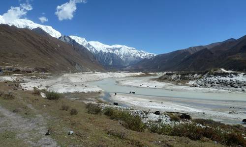
This is a 34-day trek following a section of The Great Himalaya Trail ("GHT") in Nepal crossing Lumba Sumba pass at 5,160m. We trek through a remote region on the border with Tibet from Kanchenjunga Base Camp to Makalu Base Camp.
This epic Kanchenjunga GHT trek is the longest trek and probably the most difficult in our portfolio. Our second longest trek is the Snowman trek in Bhutan with 28 days of walking. We have included the Kanchenjunga Base Camp to Makalu Base Camp GHT trek as one of the "Big 3" in our Blog article called What Is The Best Trek In The Himalayas? We have organised the Kanchenjunga GHT trek three times with groups and also we have done three reconnaissance treks so we know the trail pretty well by now. I suggest you read our Trip Reports to find out how our groups got along in 2024, 2023, and 2013. Our trekking group in 2024 successfully made the full traverse from Kanchenjunga Base Camp to Makalu Base Camp.
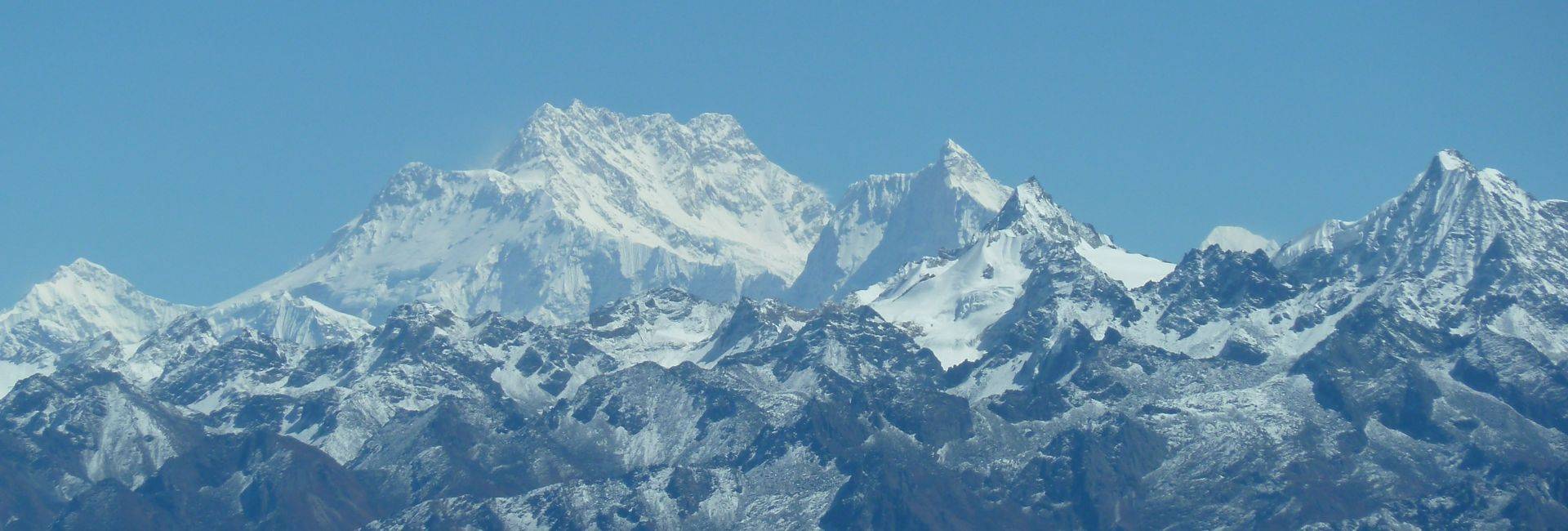
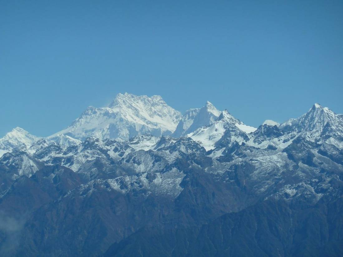
This trek follows Section 1 of The Great Himalaya Trail, which was mapped and walked by Robin Boustead. We start by walking the Kanchenjunga Circuit trek on the north side of the mountain. Mount Kanchenjunga, sometimes spelled as Mount Kangchenjunga, is at a height of 8,586m. It is the third-highest mountain in the world. This mountain is only a few hundred metres shorter than Mount Everest. From our high camp at Lhonak, we hike to Pangpema to see the vast North Face of Kangchenjunga.
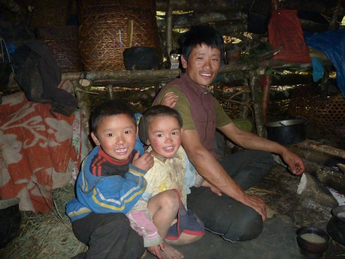
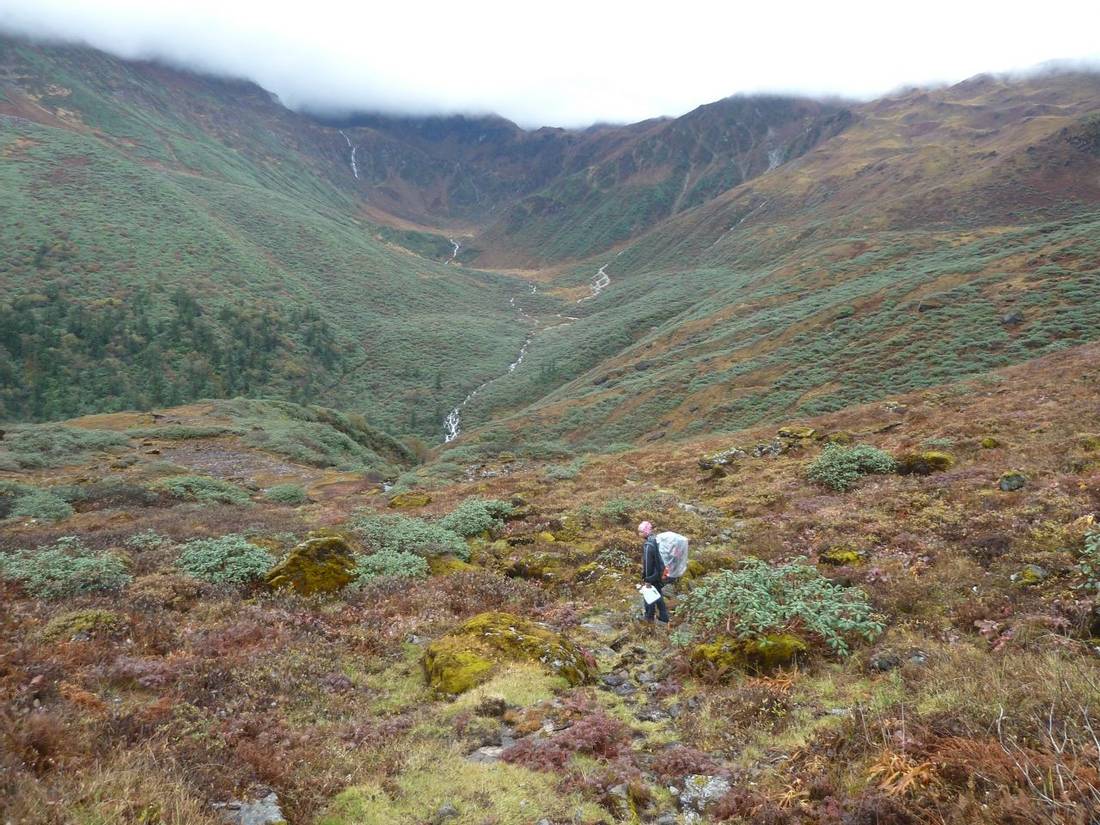
We return on the same trail back to Ghunsa. From there we start on the remote section of GHT as we head to the West. Kanchenjunga Circuit crosses the Mirgin La to the East whereas we head to the West on the Lumba Sumba trek. We cross the Nango La at 4,820m into the remote Yangma Valley and onto the village of Olangchungola. We cross Lumba Sumba pass at 5,160m and walk out to Hongon. The Lhomi ethnic group lives in this village and only inhabits the upper Arun valley. They follow Buddhism combined with Shamanism.
At Hongon, the Kanchenjunga Base Camp to Tumlingtar GHT group will start their walkout to the South. We continue westwards along the rarely trekked high trail on the Makalu Base Camp trek. At 8,481m this is the fifth highest mountain in the world. After visiting Makalu Base Camp we descend the Barun Valley and cross Shipton La at 4,125m. We walk out to the Tumlingtar airstrip for the flight back to Kathmandu.
For more information on Makalu take a look at our Blog article: Why is there a surprisingly low number of trekkers in the Makalu region of Nepal?
- We have extensive experience organising GHT Section 1 in October 2024, 2023, 2014, and 2013. For more information on how these treks went please take a look at our Trip Reports in the Reports and Reviews tab.
- We are Himalayan trekking specialists having operated trips in Nepal for many years. Roland Hunter has designed the itinerary from his first-hand experience of this trek.
- Based on client feedback we won the 2018 Gold Award as AITO Tour Operator of the Year. Read more about our Testimonials and Awards.
- We have included a gradual ascent profile in our itinerary for this trekking holiday. This will help you acclimatise to the high altitude.
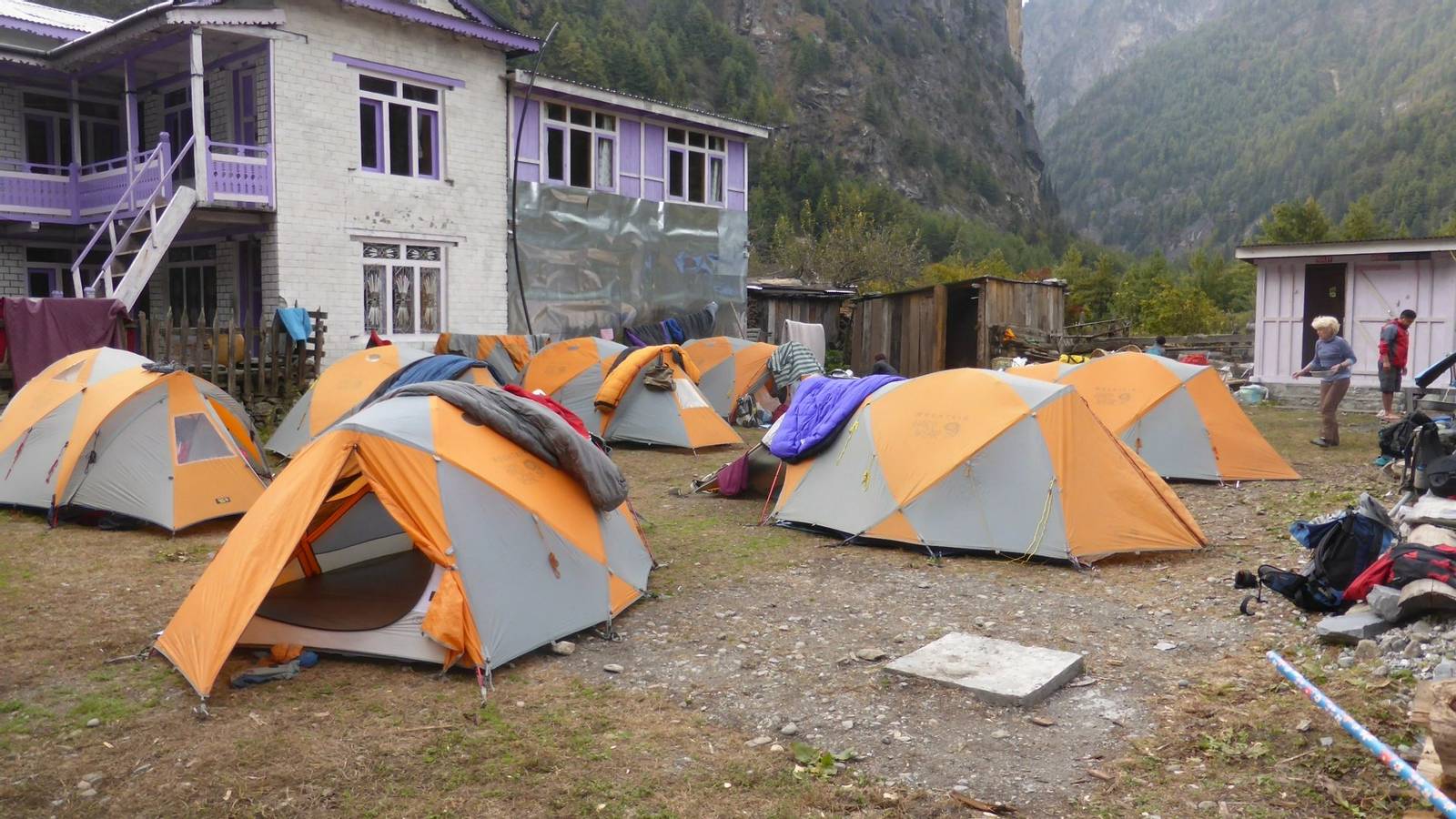
- Twin share tents while on trek using our Mountain Hardwear Trango 3 tents. These are three-person domed tents with plenty of space for two people sharing plus gear.
- We review weather forecasts for the Kanchenjunga and Makalu regions throughout the duration of this trek.
- We send a Thuraya satellite phone on our group treks in Nepal. Your leader will have reliable communications for logistics, planning, and group safety. We use GPS to upload your location daily onto Google Maps to track your progress during the trek.
- We provide the porters with windproof jackets & trousers, crampons, and shelter. We follow International Porter Protection Group (“IPPG”) guidelines.
- We provide a range of tasty meals for breakfast, lunch, and supper. For protein, we bring freezed chicken from the UK and pulses, lentils, and soya from Kathmandu. We also have a vegetable dehydrator in Kathmandu so are able to bring a range of vegetables on the trek. We give everyone in the group a chocolate or muesli bar per day. For breakfast, we provide fresh coffee from our Bialetti Moka coffee machine.
- We bring a comprehensive medical aid kit. There will also be a portable altitude chamber (PAC or Gamow bag).
- Our team with first-hand knowledge of this trek provides pre-trip support. During high season we have someone from our UK Operations team based in Kathmandu.
Route Map
Itinerary
Flying into Kathmandu on a clear day is in itself an unforgettable experience. The Himalayan peaks are only a short distance north of the capital of Nepal as seen from the plane. After customs, you will pass into the passenger pick-up area outside the building. You will see a Mountain Company signboard. Our representative will be waiting to welcome you to Nepal. After transferring to your hotel we will give you a full trek briefing. The rest of the day will be yours to explore Kathmandu and to make final preparations for the trek. You will hear the Nepalese word for hello ‘Namaste’, you will never forget that word after this holiday.
This morning your leader will give the trek briefing and check your gear. We will collect your passports from you so that we can apply for the trekking permits. The rest of the day is free to explore Kathmandu and to pack your bags. You can leave a bag at the hotel with items not needed on trek.
We take the morning flight to the small airport at Bhadrapur in the East of Nepal located an an altitude of 91m. We drive in a private bus to the town of Ilam where we spend the night in a hotel. This region is well known for its tea plantations and Darjeeling is not far away on the Indian side of the border.
Important note: there is a safety risk to consider when flying on airlines in Nepal. For information about the aviation risk in Nepal read the relevant sections “Threat and Risk Assessment” and “Internal flights in Nepal”. Please get in touch with us if you would like to discuss this further.
After breakfast, we continue the drive through tea and cardamom plantations. Along the way, we get our first magnificent views of Mount Kanchenjunga. We drive through the market town of Taplejung and then up the hill to Suketar where we meet the trekking crew.
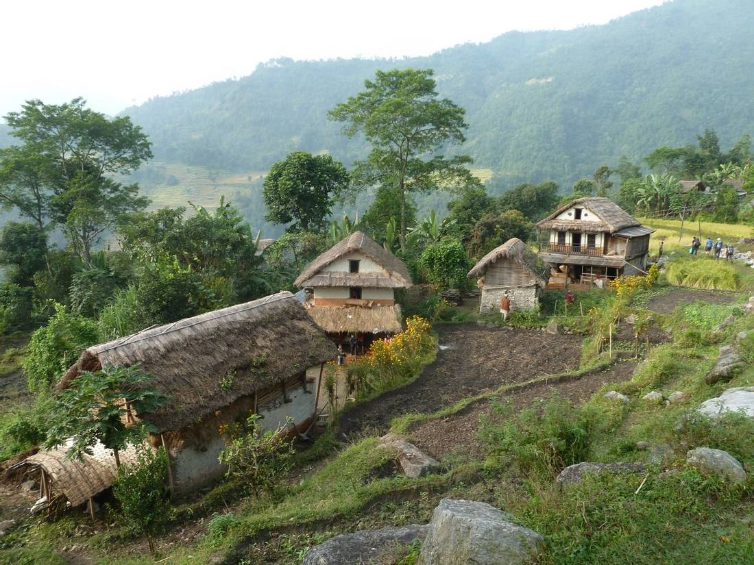
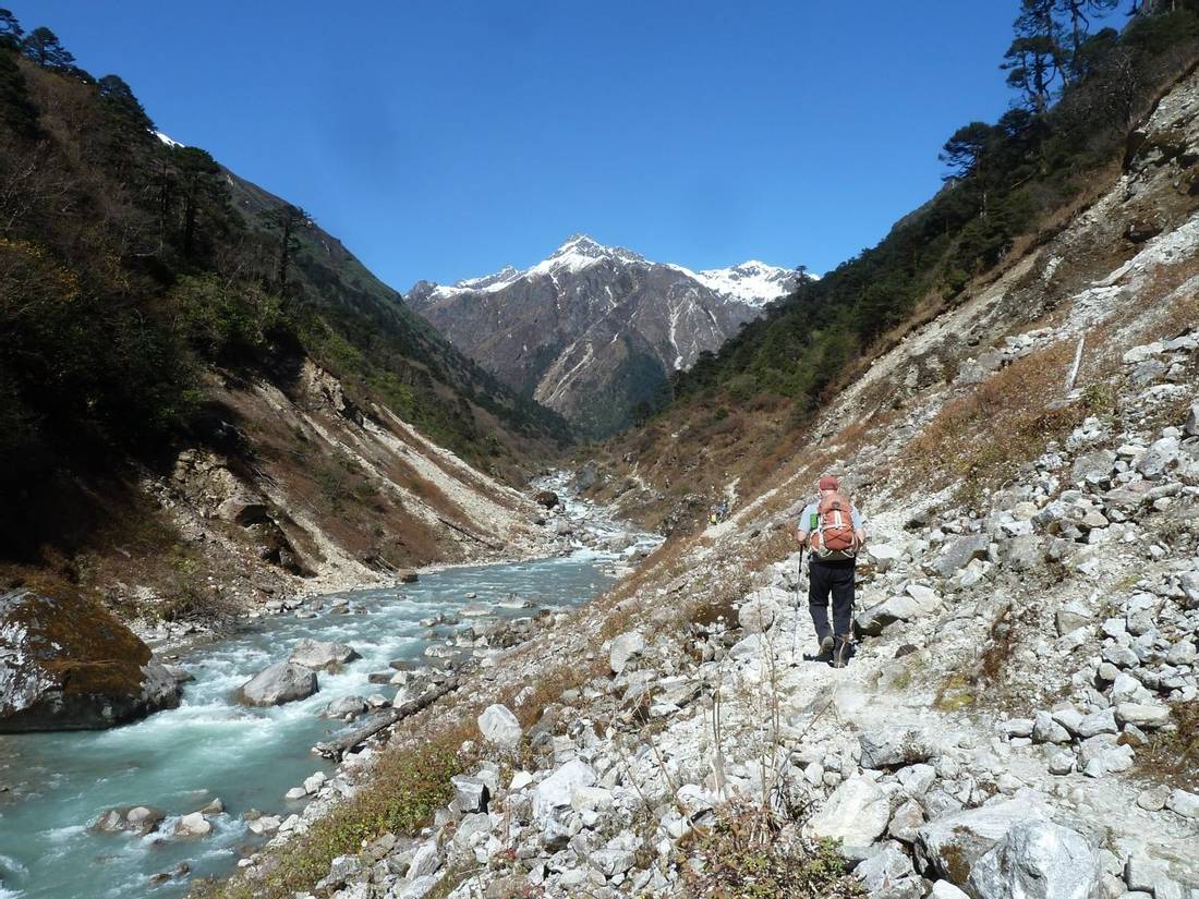
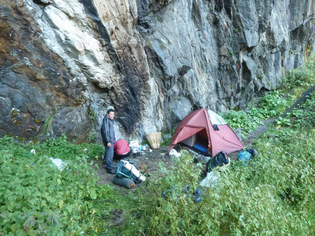
Today we drive in jeeps along a bumpy track to Sekathum. From Suketar, we descend into the Tamur Khola valley and drive alongside this river. This road was built in 2020 mainly due to a hydro dam construction project at Sekathum. It now makes sense to drive this section whereas in the past we started the trek from Suketar. We drive past our previous campsites at Mitling and Chirwa before arriving at Ranipul a short distance from Sekathum. It is a scenic drive through a fertile area with crops including rice, millet, potatoes, and vegetables. Cardamon is an important cash crop in the forest. We camp in the garden of a lodge in Sekathum and from here you get the first views of the high Himalayas where Jannu is visible on a clear day up the Ghunsa valley.
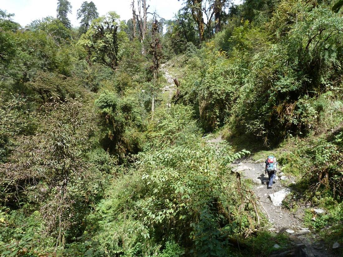
After a short walk on the jeep track from Sekathum camp, we cross the suspension bridge and follow an undulating trail through a forest in a dramatic gorge. After 2 ½ hours of walking and crossing two more suspension bridges, we arrive at the village of Phaktanglung for an early lunch. After lunch, we hike along an undulating trail on rocky staircases and pass in and out of several gullies. After a further 2 ½ hours, we reach Amjilossa high above the gorge where we camp for the night.
On leaving Amjilossa there is a short ascent to a ridge. We walk through lush bamboo, oak, and rhododendron forest. The trail has lots of ups and downs following the Ghunsa Khola. The trail condition is often slippery on rocky staircases and over tree roots. It takes 3 ½ hours to reach our lunch spot at a small clearing with a blue hut just before the metal bridge. After lunch, we cross the steel box bridge and follow the river for 20 minutes. Then 30 to 40 minutes up a steep rocky staircase sometimes through a small side valley before arriving at Gyabla settlement at 2,730m. It takes about 1 hour to reach our camp from the lunch spot.
From Gyabla, the valley opens out and we walk along an easier path for most of the way to Phole. It takes about 3 ½ hours to walk to Phole. It starts to get cooler today as we climb above 3,000m. The vegetation changes with more rhododendrons and azaleas. Before Phole, we pass through the winter settlement used by Ghunsa villagers.
At Phole village there is a monastery and you are likely to see the women weaving carpets. It takes a further 1 ½ hours to reach the larger village of Ghunsa. This is a Tibetan village with wooden houses covered in colourful prayer flags. There are lodges and shops and a small Kanchenjunga Conservation Area office. We camp in the garden of one of the lodges and will use their dining room for meals. There are hot showers available in the lodge. It is possible to stay in a room at one of the lodges for an extra charge payable to the lodge owner.
We spend two nights in Ghunsa for time to rest and acclimatise to the high altitude. It is a good idea to walk in the morning as this will help your acclimatisation. We follow the route above the village to Lobsang La. This walking trail reaches 4,000m in about 3 hours from camp and 2 hours to return to Ghunsa.
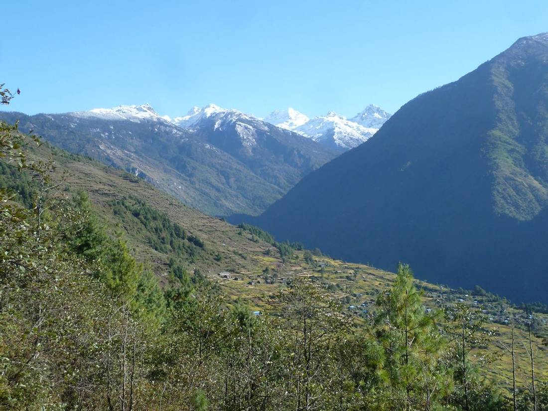
After leaving Ghunsa we walk through pine and rhododendron forest. We are on the east bank of the Ghunsa Khola and pass Buddhist mani walls and chortens along the way. After three hours we cross a bridge over Ghunsa Khola. We usually stop for lunch in a grassy area called Rampuk Kharka (3,720m). Today the mountain scenery becomes ever more spectacular. The north face of Jannu towering above is dramatic. Be careful and wear a helmet when crossing the landslide before Khambachen as there is a risk of rockfall. The trail contours the hillside and then descends to Khambachen. This is a Tibetan settlement with houses nestled in a grassy plain with mountains all around. It is possible to stay in a room at one of the lodges for an extra charge payable to the lodge owner.
We spend two nights at Khambachen at an altitude of 4,100m for essential acclimatisation. In the morning you can go for a walk. This helps your body adapt to the high altitude by following "climb high, sleep low". The walk up Nupchu Khola from Khambachen is well worth doing for the impressive views of Mount Jannu. For a longer walk, you can head up to the Jannu shrine at 4,400m. This is a 5 to 6-hour walk there and back.
From Khambachen the trail is along a lateral moraine. We pass through a seasonal yak herder’s camp at Ramtang at an altitude of 4,370m. The vegetation is azalea, juniper, and rhododendron. After an hour or so the trail becomes rockier and we pass under a landslide area where you should wear your helmet for protection. Keep moving at a steady pace and keep alert for any rockfall. We also have a river crossing along the way.
After about 3 hours of walking, we stop for lunch in a safer place. After lunch, it is a further 2 hours to Lhonak through rocky areas and cross moraines northwest of the Kanchenjunga Glacier. The campsite at Lhonak is near several basic lodges. There are superb views of Wedge Peak (6,750m), Mera (6,344m), Nepal Peak (6,910m), and Twins (7,351m) among others. It is possible to stay in a room at one of the lodges for an extra charge payable to the lodge owner.
From Lhonak we follow the trail on the lateral moraine of Kanchenjunga Glacier for two hours. We have to cross a river and pass through several sections of loose rock and landslide area. The trail climbs to reach the stone huts in a grassy area at Pangpema in a further two hours. The view of the vast north face of Kanchenjunga from Pangpema is very impressive. After eating our pack lunch we start the return walk back to Lhonak, taking about 3 to 4 hours.
We walk back along the same trail through Kambachen back to Ghunsa village.
After a tough few days at altitude and a long walk from Lhonak yesterday, most groups enjoy their first rest day of the trek so far. In the morning you can do some washing and have a chance to sort out your bags as well as recharge batteries in the lodge. You can also explore the village as it is well worth visiting the school and the gompa across the bridge.
We descend the main trail from Ghunsa for about ½ hour and turn right at a trail junction. We follow a smaller trail up the side valley following the Yangma Samba Khola. We take about 45 minutes contouring around a ridge with some steeper sections of trail. After following the river there is a steep diversion off to the right to cross a side stream in a gully. We continue up a steep and indistinct trail that goes up the left side of a rocky run-off. It finally flattens out at 4,100m as we reach the Kharka where there is a cook hut and toilet.
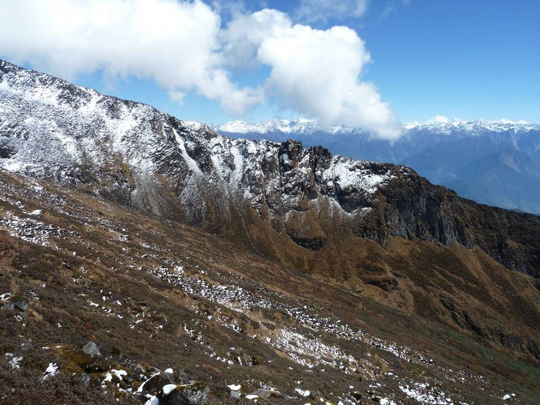
It takes about two to three hours to reach the top of the Nango La pass. From Kharka, the trail ascends to bowl around 4,500m and then heads north more steeply with a couple of false ridges before the prayer flags on the pass come into view. From the top, we can see Lopsang Peak and also Mirgin La trail over to the south side of Kanchenjunga.
The trail off the pass is indistinct but we follow some small cairns and finally descend down the centre of a valley. On the right side of the valley, we cross a small stream and then descend through muddy rhododendron bushes and onto the top of a ridge with a stream below. We descend off to the right, contour around, and eventually next to the river, staying on the right. The path is muddy and rocky and finally emerges just after the tree line to a Kharka with a cook hut.
From Kharka, the path goes down through rhododendrons and contours around. After 45 mins or so the path splits and we turn right at an indistinct junction to continue to contour. We continue contouring sometimes up and down until the path then goes down steeply a couple of times, once through a steep rocky gulley. It continues to contour before dropping again to the Yangma Khola. We follow the bank of the river up to the right for 100m to find the bridge where we turn left.
The path follows the Yangma Khola downstream but sometimes across exposed rockfall areas and sometimes climbing high to avoid gulleys. After about an hour there is a waterfall feeding a small stream to cross. Shortly after there is a bigger side river that we cross on a bridge. About 30 minutes later, after more ups and downs, there is a small hut that makes a reasonable lunch stop. This place is about 3 ½ hours from Kharka camp. After lunch, the path continues to go down and around and after ½ hour it descends sharply to a small side stream and then climbs very steeply up concrete steps.
There is a long climb and there are railings where the drop is exposed. There is a concrete platform with views of a waterfall across the valley means the top is near. The path curves around to the right above the river to join the main track to Olangchungola. This is about 1 ¼ hours after lunch. At the main track turn right to Olangchungola (or left for Taplejung). A path leads steeply off to the right just before the road fades out. We walk to the top and the road reappears by some prayer flags. From here we can see the Olangchungola monastery in the distance. It is then a steep narrow path with switchbacks to reach the village.
In Olangchungola, we use a dining room in a building where it is possible to get hot bucket showers and recharge batteries.
From Olangchungola, we follow the ‘road’ to the Tibet border. This was constructed by the locals and then stopped by the Kanchenjunga Conservation Authority. It is already heavily degraded by landslides but makes a convenient path up to the confluence of the two rivers as it has a reasonable gradient nearly all the way. Where the rivers meet the road goes right/north and our path heads west across a small wooden bridge. The stone-laid path is very clear and initially climbs above the river it then rejoins it after about 10 mins and then follows alongside. An hour or so from the bridge and shortly before the camp, the trail breaks right up a hill to get over the rise and arrive at another Kharka camp. There is a wooden hut with two rooms.
We continue walking on a stone path and then after 15 minutes, we cross a stream (sometimes there is a bridge other times not). We continue walking along a good stone-laid path going gradually up for about 1 ½ hours. Then the stone path ends and it is a steeper climb up a ridge with various false ‘summits’ and into a hanging valley. From here you see a blue wooden hut but this is not the camp. After crossing a river on a bridge follow the flat valley with yaks grazing to a trail that leads up to a high ridge (approximately 100m). Our camp is about 20 minutes from the ridge.
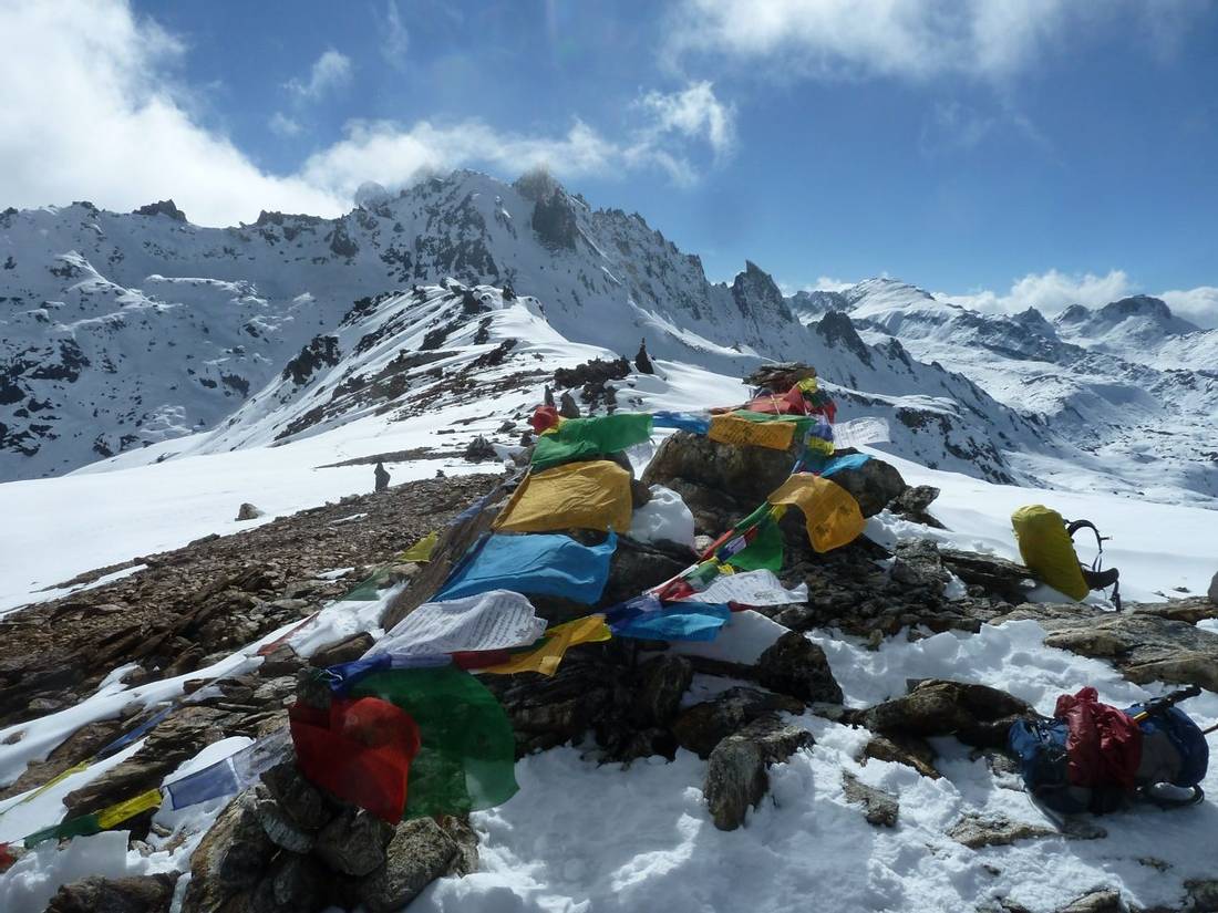
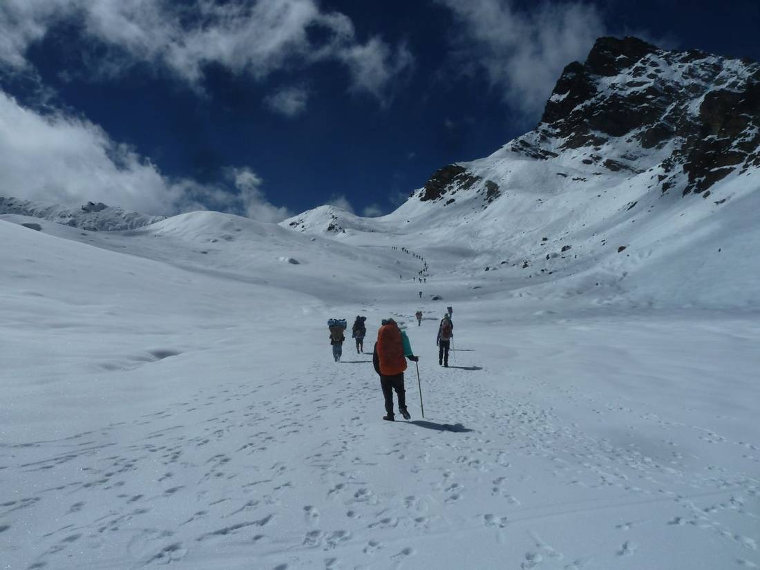
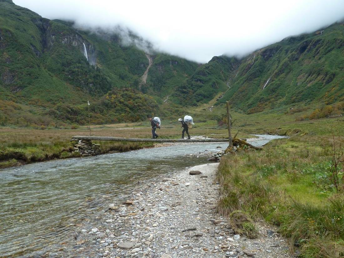
After an early start, we head to the West on a rocky trail. It is quite steep in places until we gain a plateau with views of a lake. From here we see the prayer flags on top of the Lumba Sumba pass. From leaving camp it takes 4 hours to gain the first pass at 5,050m. It takes a further hour to contour around to the second pass higher at 5,100m. There are tremendous views from both passes of Kanchenjunga and Jannu to the East and Makalu to the West. From Lumba Sumba we descend into Lapsi Khola Valley following some cairns and keeping mainly to the right, finally arriving at a camp spot near some big rocks and a stream. It takes about 3 ½ to 4 hours from the pass to camp.
The view of Mount Makalu in the morning from camp is superb and it dominates the view to the West. We follow a trail through rhododendrons and a forest to the right-hand edge of the valley. The Lapsi Khola is on our left but after an hour we cross it on a wooden bridge. Then shortly after we had to recross on rocks to rejoin the path right next to the river marked by cairns. There are a number of small streams to cross and we contour around and down sometimes across small bridges. After 4 hours we arrive at the Tibetan village of Thudam. We camp in a grassy area opposite the village over a bridge.
We leave Thudam early this morning as this is one of the most difficult days on the Kanchenjunga GHT trek. Shortly after leaving Thudam, we cross a landslide area that requires care and attention, you should wear a helmet for protection. After 1 ½ hours we reach a small grassy area with large rocks. From here we follow a very difficult section of the trail with steep rocky traverses and a slippery trail for the rest of the day until our camp at Yak Kharka. From the Kharka we climb up 300m to a small pass with signs which we reach after 90 minutes of walking. The path continues down and up and down and around. It is very steep at times with long drops and significant exposure to the side so care is needed. The trail is on slippery mud and leaves and there are greasy tree roots to clamber over. After 3 hours there is a porter platform and from here the path goes steeply down but on laid stones. The path makes its way around and over ridges and side streams. After 5 hours there is a blue-roofed house in an area of bamboo and this is known as the first kharka. We continue onwards and cross two bridges; the second, after 6 hours, is quite rotten but means you are only 25 minutes from the huts at Yak Kharka camp.
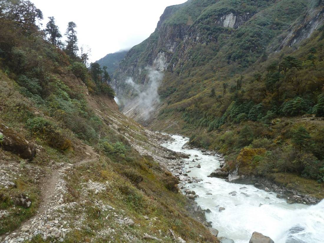
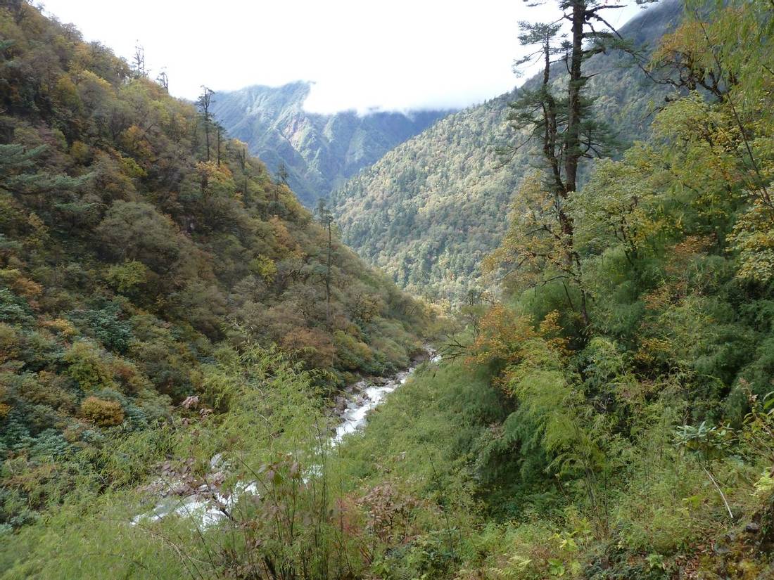
From Yak Kharka camp, the trail becomes indistinct in places through bamboo and dense forest. We ascend about 150m steeply at times to a saddle and then contours around much like yesterday. After a while, it starts to descend and after an hour there is a small outcrop with a view across to Chyamtang and the road to China carved into the white rocks. The immense scale of the Arun Valley becomes apparent. We descend to the Arun Valley with around 1,000m of descent on a muddy, rocky slippery path. After about 1 1/2 hours of descent the path is less steep and drier with less mud. We reach a suspension bridge over the Arun Khola after 4 hours of walking. There is a spot near the bridge for lunch. After crossing the side suspension bridge the path winds up steps for 400m to reach Chyamtang. This takes about 2 hours from the bridge. Chyamtang village is spread out but there is a hotel at the far end of the village with a well-stocked shop.
From Chyamtang, the route initially follows the jeep track but cuts corners. After ½ hour the track goes off to the left across a clearly-marked helipad and down through scattered houses. After ¾ hour after passing under a sign for the Yangla Hotel and Groceries, there is a police checkpoint on the right where permits are supposed to be checked. We continue down to Chepuwa on the lower path to arrive at the village via a small wooden bridge and then a short suspension bridge just downstream from a water-powered flour grinder. At the edge of the village, we keep right and then right again to follow a thick water pipe straight up to the top of the village.
At the T-junction, we turn left with the pipe and walk along the top edge of the village. It drops briefly on the edge of the village and then climbs a broad stone-laid path to the bottom of the tree line and then up through rocks and trees to five small chortens. This takes about 2 hours walking from Chyamtang. From here the trail contours around and up and then plunges steeply down with a big drop on the left where care is needed. Then it winds its way around up and down, until after 3 ½ hours of walking we reach some buildings and terraced fields and there is a view of Hongon. After that, it is a further hour contouring around and down to a long suspension bridge and then steeply up to Hongon. We walk up through the village past the school to the very top by the main road where we camp.
This is a rest day and also for organising the loads from our resupply of provisions sent from Kathmandu.
From Hongon, we walk steeply uphill following the line of the water pipe. After 25 minutes a small chorten means the path begins to flatten slightly. Then after 40 minutes, we pass another chorten and a water storage tank at the top by a muddy track. Walk up the track about 50m and then drop off to the left. The path then winds its way through a damp and slippery forest covered in moss. It is hard going and we cross two minor streams obstructed with branches. After 1 ¼ hour the trail heads left to cross a larger stream by rocks and a single wide plank bridge and then continues up through the forest. We cross a couple of small streams and then the path goes up the east bank of a river with waterfalls and pools. We cross a tributary and keep following up the east side. We cross a stream just by a grassy area (also used as a lower campsite) and then continue up the path and after 25 minutes we cross another small stream and then after 50 minutes another. Then after another hour, there is a wooden plank bridge and Bakim Kharka campsite is just across the bridge.
From camp, we continue walking through rhododendrons then higher up the trail becomes rocky. There are good views of the Arun Valley to the South. Before reaching the plateau we scramble up a rocky section to several chortens. Not far from here, we walk to the holy lake of Molun Pokhari at an altitude of 3,950m.
We walk up around the head of the lake and follow a small trail ascending up a ridge to a few faded scarves marking the top of the pass. There is a 45-minute contour to the second pass at 4,200m before descending to Dhungge Kharka where we camp.
From camp, we descend to Dhungge Khola through rhododendrons. We cross a plank bridge over the river to a large kharka on the other side and continue down the valley. We follow a small trail through dense forest on the right bank of Dhungge Khola. After 1 ½ hour we contour a ridge that draws you away from the main valley. We enter another valley to find a bridge to cross the river and we climb steeply back up to 3,250m and then levels out. Finally, we enter a broad flattish valley and cross a river on a plank bridge in a marshy area, and then another little bridge leads to a hut. This takes about 2 ¾ hours of walking from last night's camp.
The path then heads down the river through the bushes and rocks and small cairns occasionally mark the way. It opens into a few small kharkas and then into a rocky forest. The muddy path skirts up and down near the river through the bamboo and mossy rocks. Finally, after 6 hours of walking, we cross the Kolakharka Khola on a log bridge and then follow an overgrown trail to Saldim Khola. We set up camp at a herder's camp located about 1/2 hour walk below Cave Camp. We do not stay at Cave Camp as it is too small with space for only two tents.
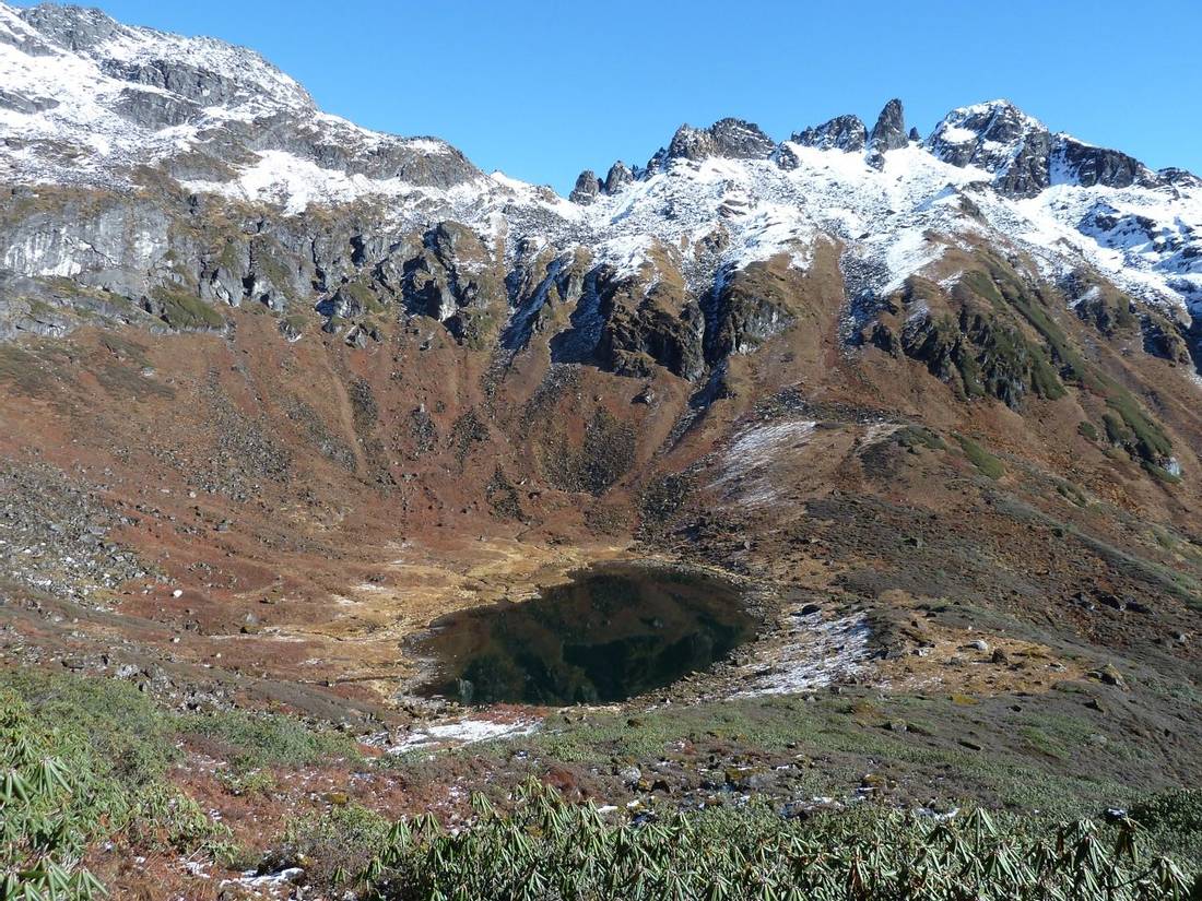
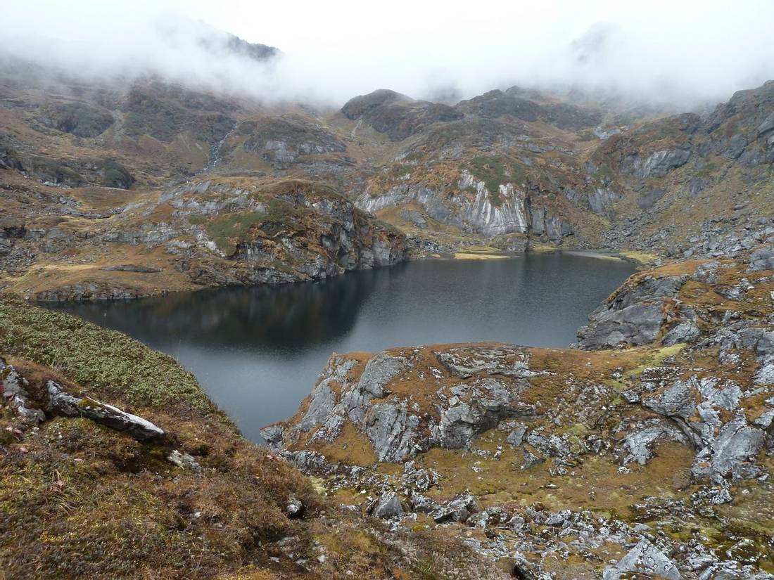
From the Herder's camp, we walk through the forest on mossy rocks and mud. It soon makes its way up a series of rocky shelves before following along the bank of the river. After about 20 minutes we cross the river and the path rises steeply along the other edge of the gulley for some time. We continue walking up the steep gulley before exiting on the left on a small trail. This ascends a steep trail to the left of a cascade. We continue climbing between two streams before the gradient begins to ease up. We pass a small lake and ascend to a ridge at 4,050m. We follow this before descending to a kharka. We climb a craggy trail around a ridge to a minor pass. We dip through a shallow valley and climb to another ridge. We arrive at a black water lake (called Kalo Pokhari) where we camp tonight.
From camp, we climb the next ridge to a pass at 4,350m before a steep, rocky descent in a gulley. If it is icey or snowy then fixed ropes will be placed to safeguard our descent. From the valley bottom, the trail climbs another ridge to a minor pass. We can see our camp in the valley below. From here it takes 1 ½ hours to descend through dense rhododendron shrubs to the kharka.
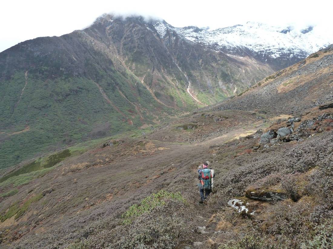
From the trail below camp, we see the tea houses at Mumbuk on the far side of the valley. We enter a forest of fir, pine, and rhododendrons. The trail descends past a cave and then we cross several streams. We reach the Barun Khola and arrive at the valley floor. We follow the river along a trail through several landslides to Yangla Kharka. There is a cluster of lodges here as we are now on the main Makalu Base Camp trekking route.
Today we pass several yak pastures (kharkas) and herder huts. These have different names and altitudes depending on the map or guidebook. We camp at Langmale Kharka where there is a lodge and terraces cleared for camping.
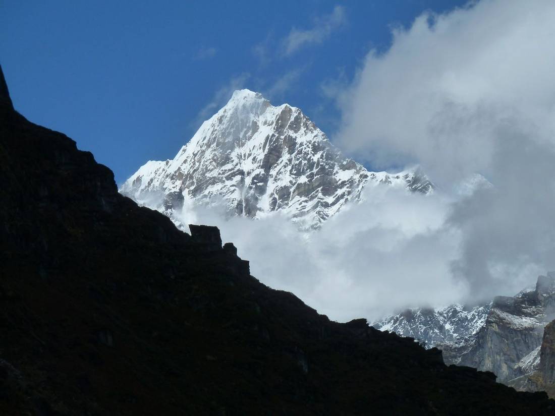
Today we do a day walk from Langmale Kharka up to Makalu Base Camp and back to Yangle Kharka. We follow the Barun valley up to Sherson and the impressive South-East ridge of Mount Makalu comes into view. As we approach Base Camp we see the immense south face of the mountain.
We cross the bridge over Barun Khola and then walk along the river until crossing a landslide area. There is a steady climb up to a lodge at Debotay where we camp before crossing Shipton La tomorrow.
From Debotay we climb to Keke La (4,150m). We descend to Kalo Pokhari Lake followed by another climb Shipton La at an altitude of 4,216m. On a clear day, there are superb views to the North of Makalu and Chamlang. We descend on a switchback trail through rhododendrons to Khongma. From there we descend steeply for a further two hours through rhododendron forest until we reach the lodge at Danda Kharka where we camp for the night.
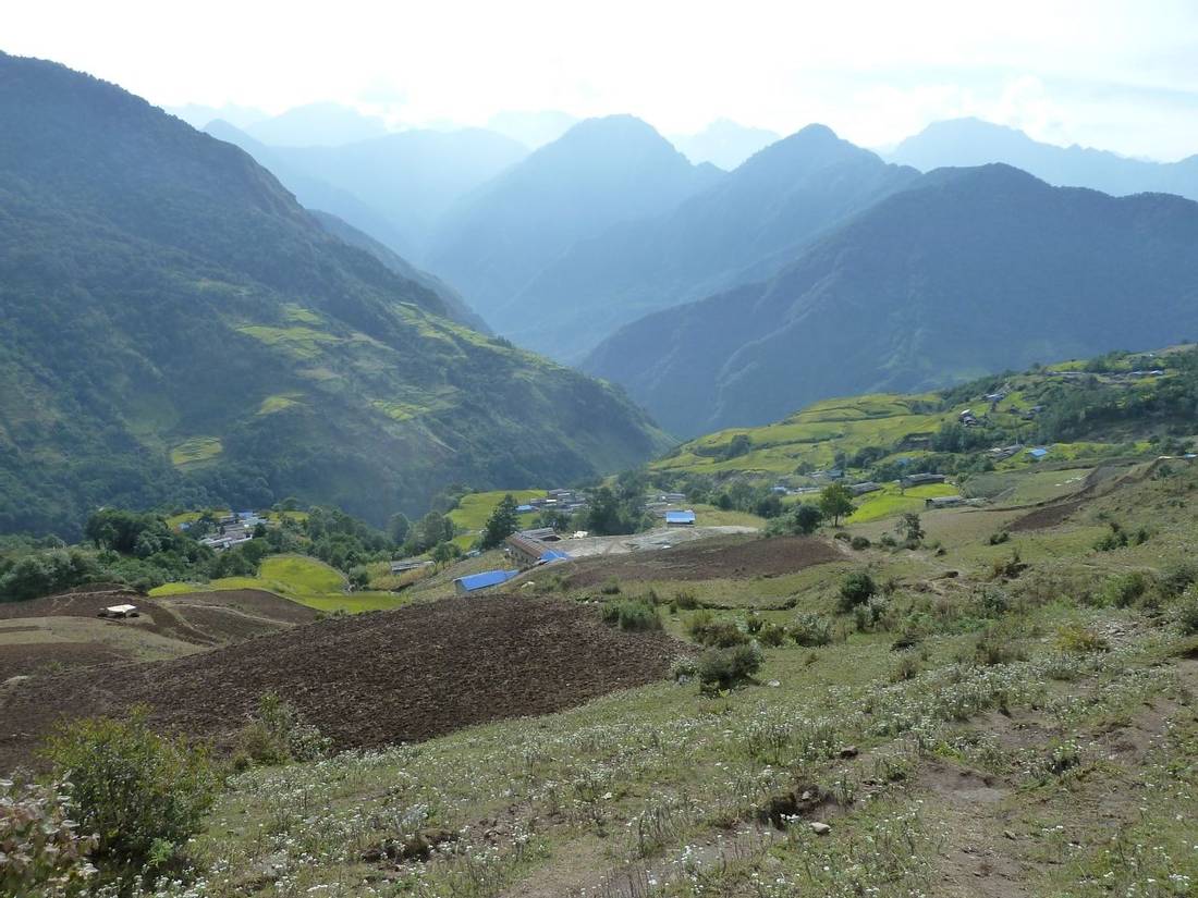
We descend further through forest and bamboo to Tashigaon village. We continue down through farmland with terraced fields lower to Seduwa village. The checkpoint for Makalu-Barun National Park is in this village.
Today we walk for about 2 1/2 hours then take jeeps along a rough road to the busy market town of Khandbari. We continue driving through terraced fields to Tumlingtar.
We take a mid-morning flight to Kathmandu. After arrival we meet our vehicle for the drive back to our hotel for the last night of the trip.
Today is a free day to relax in Kathmandu after the trek. You can do some independent sightseeing around the city. You can enjoy spending time at the restaurants and cafes. The reason for having an extra day as a buffer is in case of any delays or cancellations flying back from Tumlingtar. This helps to minimise the risk of missing your international flight back home.
Transfer from hotel to Kathmandu airport for your flight back home. End of trip.
Dates & Prices
2026
| Dates | Trip Leader | Price | Single Supplement: Room/Tent | Availability | |
|---|---|---|---|---|---|
| Dates 04 Oct 2026 to 13 Nov 2026 | Trip Leader International Leader |
Price
US$6,995pp US$6,795pp |
Single Supplement: Room/Tent US$300pp / US$700pp |
Availability
4 Left to Guarantee Early Bird Discount |
Book Now |
2027
| Dates | Trip Leader | Price | Single Supplement: Room/Tent | Availability | |
|---|---|---|---|---|---|
| Dates 03 Oct 2027 to 12 Nov 2027 | Trip Leader International Leader |
Price
US$6,995pp US$6,795pp |
Single Supplement: Room/Tent US$300pp / US$700pp |
Availability
5 Left to Guarantee Early Bird Discount |
Book Now |
2028
| Dates | Trip Leader | Price | Single Supplement: Room/Tent | Availability | |
|---|---|---|---|---|---|
| Dates 01 Oct 2028 to 10 Nov 2028 | Trip Leader International Leader | Price US$6,850pp |
Single Supplement: Room/Tent US$300pp / US$700pp |
Availability 5 Left to Guarantee | Book Now |
For private and bespoke trip, please contact us
Enquire HereWhat's Included
- All internal transport and transfers including airport collections.
- Internal flights. The flights are from Kathmandu to Bhadrapur and Tumlingtar to Kathmandu. The weight allowance is 18kg for your main bag checked into the hold and 5kg for your day pack.
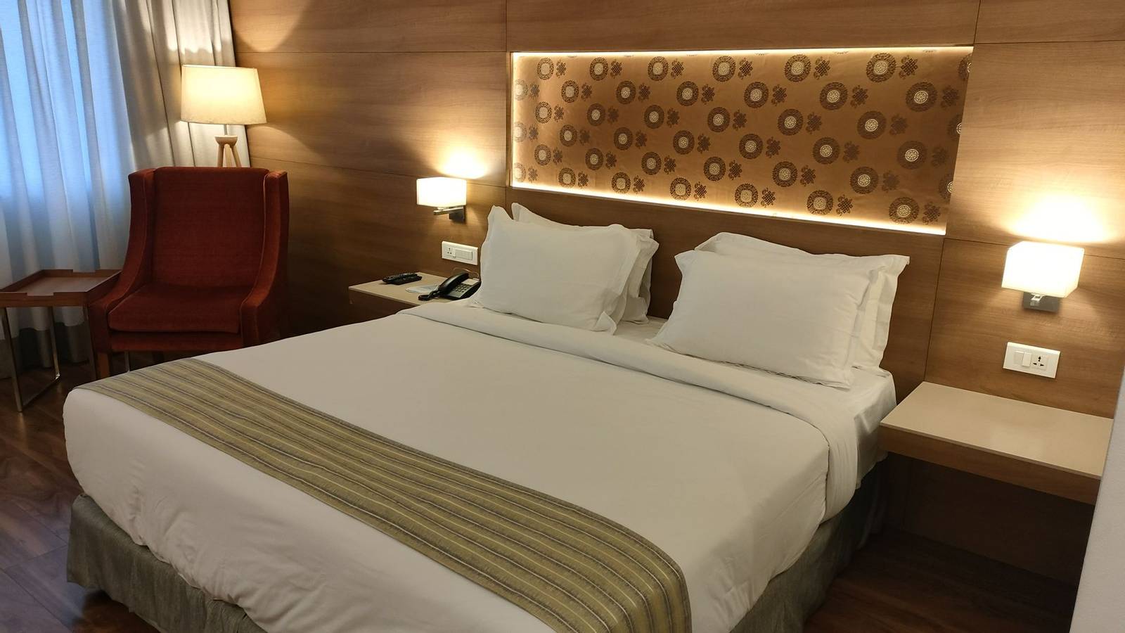
- Twin-share rooms at Hotel Ambassador in Kathmandu.
- Breakfast only in Kathmandu, all meals are included while on the trek.
- Twin share tents while on trek using our Mountain Hardwear Trango 3s. These are three-person domed tents with plenty of space for two people sharing plus gear.
- Trekking arrangements. Including permits and fees, tents, International and Nepalese guides, porters, and cooks.
- Porters to carry your main bag. The porterage allowance is 18kg.
- Weather forecasts for the Kanchenjunga and Makalu regions during your trek.
- Thuraya satellite phone for organising logistics and medical evacuations. It can also be also used for personal calls at extra cost.
- GPS tracking on Google Maps. Your friends and family can track your progress during the trek.
- A trekking map is given to you on arrival to Kathmandu.
- UK-registered charity, Pipal Tree, will plant 14 trees for you in the Gurkha Memorial Forest in southern Nepal.
- Full financial protection for bookings from the UK (ATOL) and internationally (ABTOT). Our Air Travel Organiser’s Licence (ATOL) number is 10921. Our Association of Bonded Travel Operators Trust (ABTOT) membership number is 5365).
- Pre-departure support and advice from The Mountain Company. We are available by email, phone, Zoom, or face-to-face meetings.
What's Not Included
- International flight to/from Kathmandu.
- Travel & trekking insurance.
- Nepal visa for 90 days.
- Lunch and evening meals in Kathmandu.
- Personal clothing & equipment, please see the Appendix for suggested kit list.
- Tips to the trek crew. Each trekker should budget for giving tips into the group fund. This should be in the region of 60,000 Nepalese rupees (approx. £300 or US$400)
- Other items not listed in “What is included”.
Accommodation
Camping in Nepal
We use both Mountain Hardwear Trango 3.1s and Quechua tents for our camping treks in Nepal.
Hotel Ambassador in Kathmandu
We have used Hotel Ambassador in Kathmandu for our groups since it was rebuilt in 2017. Since then we have received positive feedback on their service and location. This is our first choice hotel for trekking groups in Kathmandu. Rooms are well appointed with a reliable supply of hot water for use in the shower. The windows have double glazing so it keeps the rooms very quiet. They serve an excellent breakfast buffet from 7am to 10am. A sundowner on their rooftop bar and restaurant called Foreign Affairs is a must do!
Practical Information
Typical Day On Camping Trek in Nepal
We provide a comfortable experience on our camping style treks. Our team works hard to support you so that you can relax and enjoy trekking in Nepal. We provide personal tents, mess tent, kitchen tent and toilet tent(s). The camp will be set up and dismantled by the trek crew. We bring along a cook and kitchen helpers to provide the meals.
The day starts with an early morning mug of tea brought to your tent by one of the trek crew. Before heading for breakfast you pack your overnight gear into your duffel bag. During breakfast the trek crew pack away the tents. The porters arrange their loads and set off on the trail in the cool of the morning. After breakfast, between 7am and 8am, we start walking.
The pace of the trek is moderate as there is plenty of time in the itinerary to reach the camp for tonight. There will be plenty of time to enjoy the scenery, take photos and explore the local villages. Lunch will be around midday at a spot by the side of the trail. Our cooks prepare lunch for us and the food is usually ready by the time the group arrives.
After lunch we continue the walk and on most days we arrive to camp by mid afternoon. Some of the trek crew would have gone ahead of the group to set up camp and to put up the tents. On arrival to camp you will get a hot drink and biscuits. In the evening our cook will provide a three course meal in the mess tent around 6pm.
After supper the leaders will discuss the plan for the next day. Afterwards people might stay in the mess tent chatting about the day’s events or playing cards. After a tiring day most people head to their tent quite early for the night. Tomorrow is likely to be very similar as today! The only difference is that if we are crossing a high pass or climbing to a summit we leave camp earlier in the morning.
You can read more about our Camping Treks in Nepal on our Blog. This article explains the advantages of camping versus teahouse lodge treks. It also describes what the campsite set up is like and more about the food provided by our cooks.
Food provided on Camping Trek in Nepal
While on a camping style trek in Nepal we provide tasty and nutritional food. We make sure there is more than enough quantity to go around as trekkers will be hungry after a long day on the trail. Over the years we have worked on increasing the variety of the menus. We have expanded the list of ingredients provided to the cooks so they have more to work with. Also in 2015 we purchased two food dehydrators with a vacuum sealing machine. We dehydrate a large number of different vegetables in Kathmandu before departure. This has transformed the quality of food especially on longer treks to remote areas.
For breakfast we provide porridge or cereal, toast or chapatis and eggs. There will be hot drinks including tea, herbal teas, hot chocolate and coffee. We provide fresh coffee from our Bialetti Moka coffee machine.
For lunch we stop at a convenient spot with water at the side of the trail. The cook and kitchen walk ahead of the group in the morning and lunch should be ready shortly after our arrival. After lunch we have time to relax before starting to walk again in the afternoon.
On arrival at camp in the afternoon you have biscuits and a hot drink such as tea or coffee. Around 6pm we serve a three course meal in the mess tent. The starter is often soup with popcorn or poppadoms. We have a range of main dishes and carbohydrates including rice, potatoes or pasta.
We cater for a variety of dietary requirements. Our meals are suitable for vegetarians. If there is a meat dish then we also provide vegetarian options as standard. During booking we find out if you have any dietary needs and agree upon meal plans before departure. If you have any questions about the food provided please get in touch with us to discuss further.
Communications
We bring a Thuraya satellite phone for logistical, safety and personal use. Personal calls charged at £4 (US$5 or €4.50) per minute and £2 (US$3 €4.50) to send and receive SMS text.
Kit List for Kanchenjunga GHT trek
This is the mandatory kit list for the safety of everyone in the group and to ensure a successful trek. You must have the following items tailored for the Kanchenjunga to Makalu GHT trek. The group leader will check your gear in Kathmandu before departure for the trek.
As a reminder, the weather on this trek will vary from season to season and day to day as you ascend to higher elevations. At the start of the trek you will experience hot conditions with temperatures up to 25 Celsius. You experience the coldest temperatures in Lhonak at an altitude of 4,785m. Overnight lows here will be down to around -15 Celsius.
You should bring a rucsac or backpack for gear required during the day. Your pack should contain items such as warm clothes, a jacket, a camera, water bottles, a personal first aid kit and snacks. The weight limit is 5kg. A porter will carry the rest of your personal equipment packed in a duffel or kit bag. The weight limit for your duffel bag is 18kg. Please mark your bag on the outside for easy identification.
Print the kit list and tick items off as you pack them then weigh your kit bag before you come on trek.
Footwear
- Walking Boots. A pair of water-repellent boots with ankle support. Boots must be in good condition, the best approach is to get new boots and break in before the trek. Over the years we have had several boots fall apart so you should also bring trail shoes as a backup.
- Trail shoes. Used around camp and as a replacement if your walking boots fall apart!
- Sandals. Enclosed sandals are best to protect your feet during river crossings. Required for river crossings as well as two trekking poles.
- Walking socks.
Clothing
- Waterproof and Windproof jacket (with hood) and trousers (Goretex or similar). For use if it rains or snows during the trek and in windy conditions.
- Trekking trousers.
- Soft Shell Trousers.
- Long-sleeved tops or shirts (not cotton).
- Micro fleece.
- Mid to heavyweight fleece or synthetic/ primaloft top.
- Sleeveless/ gilet or body warmer type fleece / synthetic top. This will help keep your core warm while not bulking when layering up. Gilet is used in combination with base layers, other fleeces and a down jacket. This provides the most warmth and insulation.
- Thermals or base layer for top & bottom (merino wool or synthetic).
- Fleece or synthetic leggings. Worn around the camp or added as a layer when the temperatures start to drop higher up.
- Medium-weight down jacket.
Head and Gloves
- Fleece gloves.
- Warms mittens and/or gloves.
- Wool or fleece hat.
- Sun hat.
- Bandana or scarf (eg. Buff Headwear).
- Head torch. Bring extra batteries.
- Sunglasses. They should have side protection or a wraparound design.
For crossing the passes
- Trekking poles. Two poles are mandatory for your safety. These will be helpful on steep sections of the trail and river crossings. Also for walking on snow or ice higher up.
- Kahtoola Microspikes or YakTrax Summits. These are for your security when descending passes with snowy or icy conditions. They fit onto your walking boots.
- Helmet (mandatory as there is a risk of rock fall).
- Gaiters. A pair of knee-high gaiters is used to keep boots dry if walking through deep snow.
Personal equipment
- Sleeping bag. Overnight lows down to -15 Celsius. It is possible to rent a bag from Shonas Rental in Kathmandu.
- Fleece or silk liner for your sleeping bag. A liner protects your sleeping bag from getting dirty. Also helps by adding extra insulation to keep you warm at night.
- Sleeping mat (eg.Thermarest). On trek, we provide everyone with a foam mat. We recommend two layers for insulation and comfort. We also provide everyone with a pillow.
- Day pack. The recommended size is around 40 litres. You need to have enough space to carry water bottles, a camera, snacks, extra clothing and climbing gear. The pack should have a good waist belt. It is also a good idea to bring a rain cover to keep the contents dry.
- Stuff sacks for keeping your gear dry and organised. Or even better are fold dry bags such as from Exped.
- Two water bottles. Nalgene wide-mouth bottles are the best. You may use a hydration pack lower down but the tube will freeze in the cold so ensure you still have two water bottles.
- Pee bottle. Recommended as means you do not have to get up to find the toilet tent at night! For men, you can use an old water bottle. For women take a look at SheWee.
- Sunscreen and lip salve with a high SPF.
- Water purification tablets with chlorine dioxide. This kills bacteria, viruses, and cysts including Giardia and Cryptosporidium without leaving any residual taste, odour, or colour.
- Favourite snack food.
- Books and cards etc.
- Camera with spare batteries and memory cards.
- Solar panel and battery bank. For use to recharge devices on the remote GHT section of the trek away from lodges.
- Insurance certificate.
- Earplugs (optional).
- Baby wipes (optional).
- Hand sanitizer. Keep this in your day pack for use after a toilet break during the trek or before eating any snacks. We provide sanitizer for use before meals.
Travelling
- Duffel bag for your personal gear on the trek. Will be carried by a porter. Rugged and waterproof made of a plastic material. Size 100-120 litres. Eg. Mountain Equipment 100l or Rab 120l. Bring a small combination padlock to secure the bag.
- Travel clothes. You will need casual clothing for air travel days and time spent in Kathmandu.
- Toiletry bag with soap, travel towel, toothbrush etc. We provide toilet paper while on trek.
Personal first aid kit
We provide a comprehensive group first aid kit. Please bring personal medications and other items you might use such as:
- Any personal medications.
- Blister treatment (Compeed patches are the best)
- Rehydration powder (eg Dioralyte).
- Analgesics (paracetamol, ibuprofen and aspirin).
- Plasters and zinc oxide tape.
- Throat lozenges.
Risk assessment for Kanchenjunga GHT
You should be aware trekking in a developing country involves a risk of personal injury or death. You must accept these risks and be responsible for your own actions and involvement. Adventure travel requires an open and flexible attitude. You may experience extreme conditions and unpredictable weather. There could be last-minute changes to the itinerary beyond our control. The ability to work in a team is an important aspect of our trips.
We have performed a threat and risk assessment for our Kanchenjunga GHT trek. Our trips have a degree of risk. This is part of the attraction of adventure travel and why so many people choose to join this type of holiday. By identifying the hazards we assess the level of risk. We have control measures in place to reduce this happening or to reduce the impact.
Our risk assessment is available to clients on request. We have listed below a summary of the significant risks and hazards identified by us:
- Falls and trips resulting in physical injury eg. slipping on ice or falling off the path.
- Altitude illness including but not limited to AMS, HACE, and HAPE.
- Getting lost or becoming separated from the group.
- Severe bad weather and conditions when camping.
- Climatic injuries (dehydration, sunburn, heat exhaustion, hypothermia, or heat stroke). Please note at the start of the trek it will be very hot and humid for the earlier days.
- Crossing a river with no bridge resulting in drowning and/ or a fall.
- Rockfall and landslides.
- Snow and ice avalanches.
- Lightning strike.
- Wildlife, pack animals (e.g. donkeys or horses), or stray dogs. Pack animals can knock people off the path. Dogs can attack and bite. Discuss rabies vaccination with your doctor.
- Earthquake.
- Risk of fire in the hotel or lodge.
- Endemic local diseases. Discuss vaccinations with your doctor before departure.
- Physiological injury. Such as heart attack, appendicitis, hernia, toothache, etc. in a remote area.
- Road traffic accidents.
- Flight accidents. Read paragraph “Internal flight".
- Contaminated food and/ or water.
This trip visits a remote area. You are away from the usual emergency services and medical facilities. Evacuation for a serious injury requiring hospitalisation could take up to several days. This delay could impede your ensuing recovery. Helicopters are the usual means of evacuation. They are not always available or hindered by poor weather and flying conditions.
Internal Flights in Nepal
Flights from Nepal’s Short Take-Off & Landing (“STOL”) airstrips are dependent on weather. Delays often happen if there is poor visibility or high winds. For our itineraries with flights to or from STOL, we include one extra day in Kathmandu at the end of the trip. This is in case of delays flying back. If the delays are longer we will help reschedule your international flights. There is likely to be a fee charged by the airline for this. You also have to pay for costs incurred in Kathmandu as a result of the delay such as accommodation and meals.
You should read the Foreign, Commonwealth, and Development Office (“FCDO”) travel advice for Nepal. For their latest advice take a look at their Safety & Security section under Air Travel. There have been some recent air accidents in Nepal. The European Union has banned Nepalese airlines from flying to Europe. For more information on Nepal’s air safety profile take a look at Aviation Safety Network.
Weather and conditions for Kanchenjunga GHT trek
We have chosen the dates for optimal conditions on the high passes. This is based on experience learnt from our Kanchenjunga GHT treks in October 2023, 2014 and 2013. The best time in Autumn season is to start towards the end of September. The monsoon should be winding down although the exact date varies year to year. In some years there is monsoonal rain during the start of the trek. The key reason for starting earlier in the Autumn season is to place the group in Makalu in early November. This means we should be able cross the passes into and out of this remote region before the winter snows block the trail.
We have written a blog article When is the best time to go trekking in Nepal Himalaya? This has information about the weather and conditions in Spring and Autumn seasons. It also explains the differences between the trekking regions of Nepal.
Suggested reading and maps for Kanchenjunga trek
Maps
Kanchenjunga by Himalayan Maphouse Trekking Maps of Nepal. Scale: 1:100,000. We include this map in your welcome pack when you arrive in Nepal.
Nepal Trekking Map Himalayan Maphouse Scale: 1:900,000
Books
Kanchenjunga the Untrodden Peak by Charles Evans.
The Hard Years by Joe Brown
The Kanchenjunga Adventure by Frank Smythe
Round Kanchenjunga by Douglas Freshfield
Living on the Edge: The Winter Ascent of Kanchenjungaby Cherie Bremer-Kamp
Kanchenjunga; First Ascent from the North-East Spur by Col Narinder Kumar
Kangchenjunga Himal and Kumbhakana by Jan Kielkowski
The Ascent of Rum Doodle by WE Bowman
Nepali Phrasebook by Lonely Planet
Trip Reports
To read our trip report please click on the link below to our blog:
Kanchenjunga Base Camp to Makalu Base Camp in October 2025 led by Ben Walker
Kanchenjunga Base Camp to Makalu Base Camp in October 2024 led by Robert Mads Anderson
Kanchenjunga Base Camp to Makalu Base Camp in October 2023 led by Ade Summers
Recce from Arun Valley to Makalu Base Camp in October 2014 led by Roland Hunter
Kanchenjunga Base Camp to Makalu Base Camp in October 2013 led by Roland Hunter
Trip Reviews
Review by Karen 15/01/2026
Two base camps, remote villages, challenging conditions - excellent adventure! Arduous trekking to Kanchenjunga BC across parts of the GHT to Makalu BC. A mix of hotel, tea house, camping ,and remote camping. Excellent support by the porters and guides. Adapted itinerary based on current and expected weather conditions. From top to bottom, excelle nt support. Roland screened applicants for this challenging trek, provided intent and direction to his staff. Bhim (lead guide) worked well with his assistant guides and Ben (western leader) to make sure we were as comfortable as possible. Porters and kitchen staff were friendly and provided excellent service in sometimes difficult conditions. Good communication throughout the trek, as we had to make changes to the itinerary based on weather conditions. ...
Show more Show lessReview by Jo on 15/12/2025
A Unique and remote Himalyan journey: Trekking through the beautiful and varied terrain of Eastern Nepal, from lush rice paddies and remote villages to high passes and 2 stunning base camps. The entire crew were competent, friendly, fun and responsible, with great support from the Kathmandu-based team throughout. Shout out to the cook & cook te am for amazing food and service! A long trek like this section of GHT requires flexibility, has more of an expedition feel and the length of time out on trek (35 days) meant that we were fully immersed in the experience and landscape. Views and scenery along the trails are outstanding and would highly recommend if you are lucky enough to have the time fr a trek this long. We were very well looked after for the duration, great food, focus on safety and slick organisation despite curve balls from weather etc. TMC are very client-focussed, constantly listening and reacting to feedback and clearly well connected to local teams and communities. ...
Show more Show lessReview by Lawrence on 09/12/2025
Kanchenjunga to Makalu BC Great Himalayan Trail Trek This was a long and remote trek in the Eastern part of Nepal, close to the Tibetan border. We were fortunate with good weather and fantastic views at either end of the trek, but had to re-route in the middle of the trek following a period of unusually heavy rain and snow as a consequence of a la te cyclone in the Bay of Bengal. Our sirdar, sherpas and leader, with assistance and weather forecasts from the Mountain Company team in Kathmandu via satellite phone, were able to adapt the route to enable us to complete the trek and reach Makalu Base Camp. Our porters and kitchen crew also made a huge contribution to allowing us to complete the trek. Overall, a fantastic experience in a remote part of Nepal with a friendly and enthusiastic group of fellow trekkers and great support from our international leader, sirdar, sherpas, cook, kitchen crew and porters. This was the third trek that I have done with the Mountain Company. Their focus exclusively on treks in the Himalaya and Karakoram, along with their base in Kathmandu as well as the UK, means that they bring an enormous amount of local knowledge and experience to the organisation of their treks. Their attention to detail and realistic and flexible itineraries attest to this. I would not hesitate to trek with them again or to recommend them to others. ...
Show more Show lessGallery


Related trips
Lunana Snowman

Lunana Snowman is a long trek over many high passes through remote a region in Bhutan Himalaya.